©Luke Massey/2020VISION
County Wildlife Sites
County Wildlife Sites (CWS) are areas of land that are rich in wildlife. They sit outside of the nationally protected areas, such as Sites of Special Scientific Interest and National Nature Reserves.
There are more than 1,300 CWS in Norfolk, making them a fantastic resource for wildlife and a great support network for locally and nationally threatened species and habitats. They complement protected sites by maintaining links between habitats, which helps nature recovery across Norfolk.
CWS do not receive statutory protection, but they are given some protection through the planning system. Norfolk Wildlife Trust plays a key role in advising planning authorities, developers, and others on their protection. There are no legal constraints on the management of CWS but we visit many sites across Norfolk each year, providing advice to landowners on wildlife-friendly management for these sites.
Please be aware that many County Wildlife Sites are privately owned and are not open to the public.

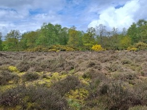
Pentney Heath (credit: NWT)
The CWS system in Norfolk is managed in partnership by Norfolk Wildlife Trust, Norfolk Biodiversity Information Service (NBIS), Norfolk County Council, Natural England, the Environment Agency, the Broads Authority and others, with Norfolk Wildlife Trust taking the lead role.
Our CWS survey programme updates information on existing sites and notifies new sites. NBIS collates this information and sends annual updates to all local authorities and statutory bodies in Norfolk.
The criteria for a CWS can be found in the handbook below:
For more information about County Wildlife Sites and how NWT can help, read our CWS information leaflet:
Claylands - hedges (credit: Matt Jones)
Habitat management advice for your land
If you’d like specific habitat management advice for your land, start by reading our Introduction to habitat management and go from there!
Get in touch

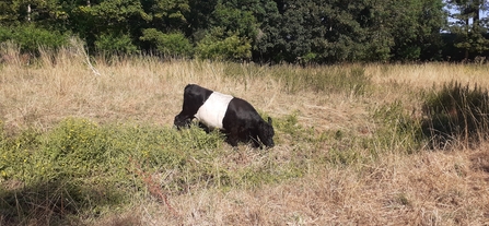
A belted galloway cow in Haddiscoe (credit: NWT)
For more information about our County Wildlife Site team and their work, email: cws@norfolkwildlifetrust.org.uk
